WHO WE ARE
Techno Mappi Geo solution established in the year 2019 is a professional GIS services company specializing in the development of intelligent, enterprises wide geospatial solution for clients in various discipline and industry such as smart cities, Government sector, utilities, Transportation and Property development. Our core competency lies in building a scaled geospatial platform at high quality solution with optimized cost
Chat with us
GIS
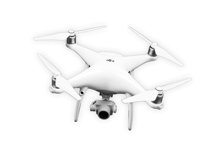
LiDAR & UAV
Orthomosaic
Photogrammetry
APPLICATIONS
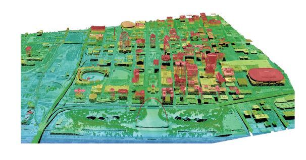
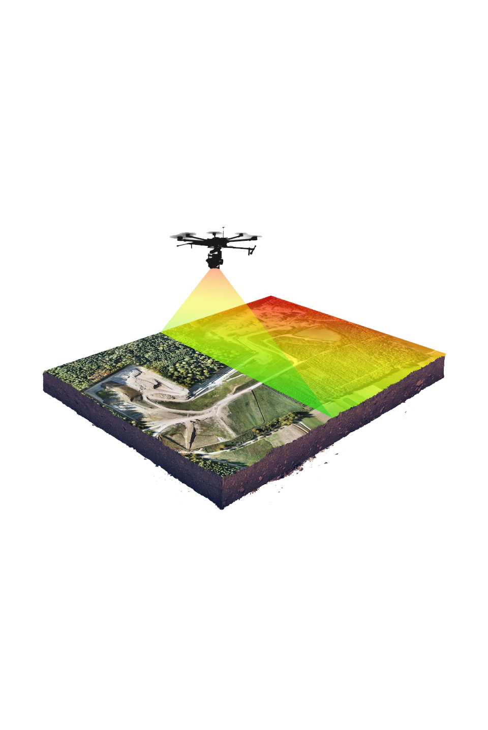
Managing Assets with Mobile LiDAR
Cities are leveraging mobile LiDAR to manage assets and ensure safety standards. For example, inventories include everything from potholes, road conditions, bridge damage, utilities, billboards, and street signs.
Upon collection, scans are destined into geospatial databases. This way, they can store, analyze, and visualize each infrastructure asset – which is the primary function of a Geographic Information System (GIS)
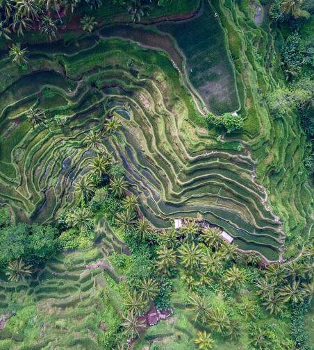
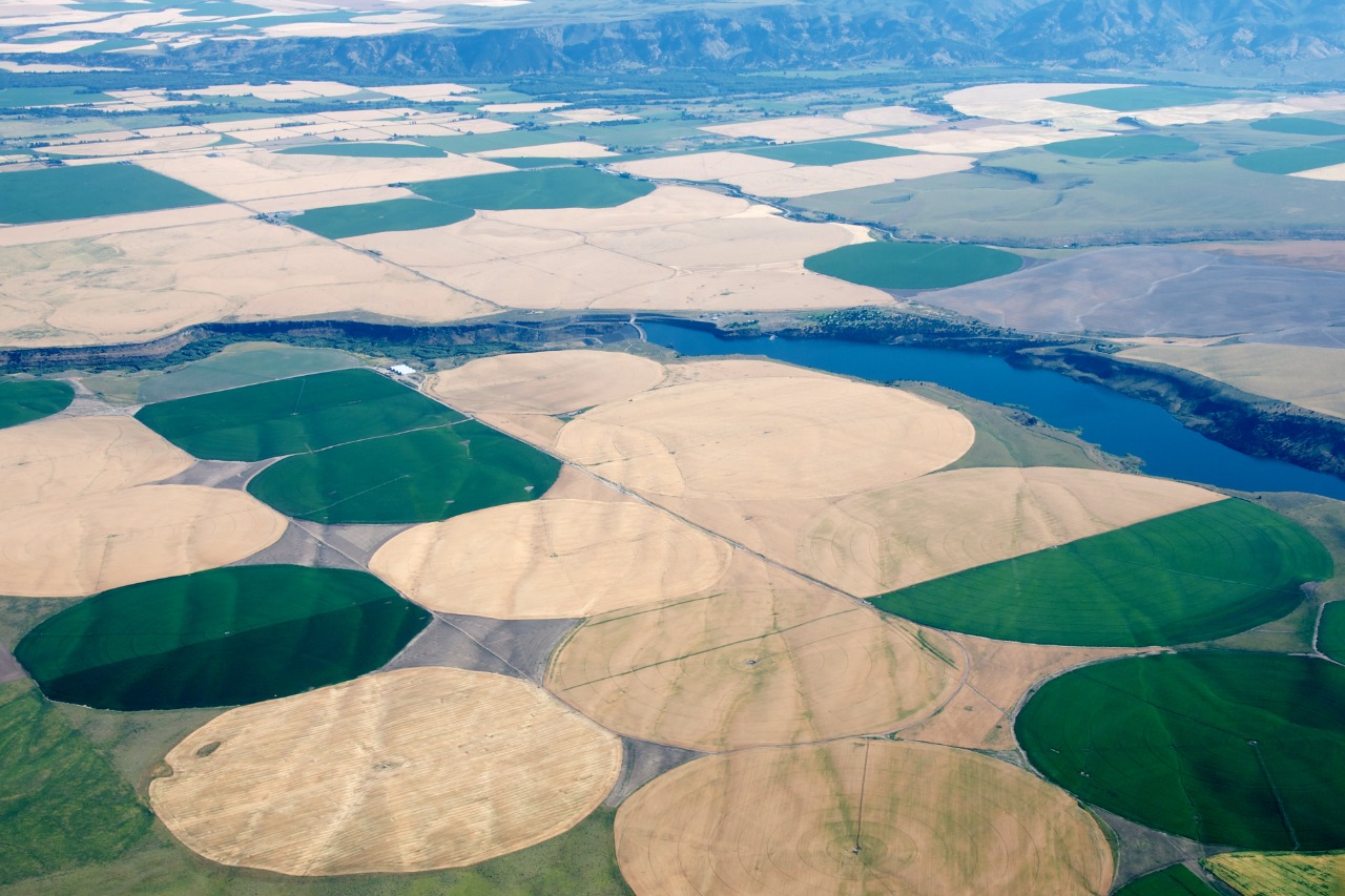
Determining Land use and Land cover
The LiDAR classification codes include ground, vegetation (low, medium, and high), building, overhead wires, roads, rail, and water.If point classification falls into more than one category, vendors flag it with a secondary class.
Each code comes from the reflected laser pulse mostly in an automated way. Land cover is a stable in understanding the changing dynamics of our planet including climate change
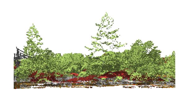
Forestry
Visualizing tree structure and height in forests is an area where LiDAR really succeeds.When you know the height of the tree and the height of the ground, you get a true vertical profile. But if you really want a 3D vegetation structure, terrestrial LiDAR generates realistic three-dimensional representations.
In fact, the Geoscience Laser Altimeter Systems (GLAS) was the first laser-ranging (LiDAR) instrument to map out our forests from space
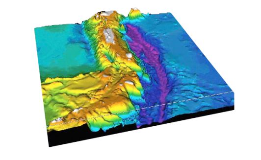
Exploring Underwater Bathymetry
Typically, bathymetry soundings (or sonar) are used for underwater surveys. Sonar emits pings of sounds and listens for an echo. Similar to LiDAR, it calculates the distance by measuring the elapsed time of the echo. Bathymetric Lidar is different from airborne LiDAR because it uses a green wavelength.
By using this type of wavelength, underwater mapping can measure all the way to the seafloor. Similarly, river and bathymetric surveys are capable of mapping both terrestrial and aquatic systems.
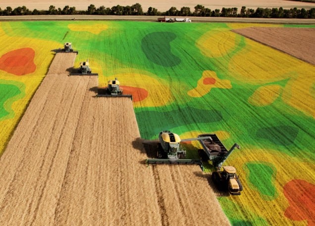
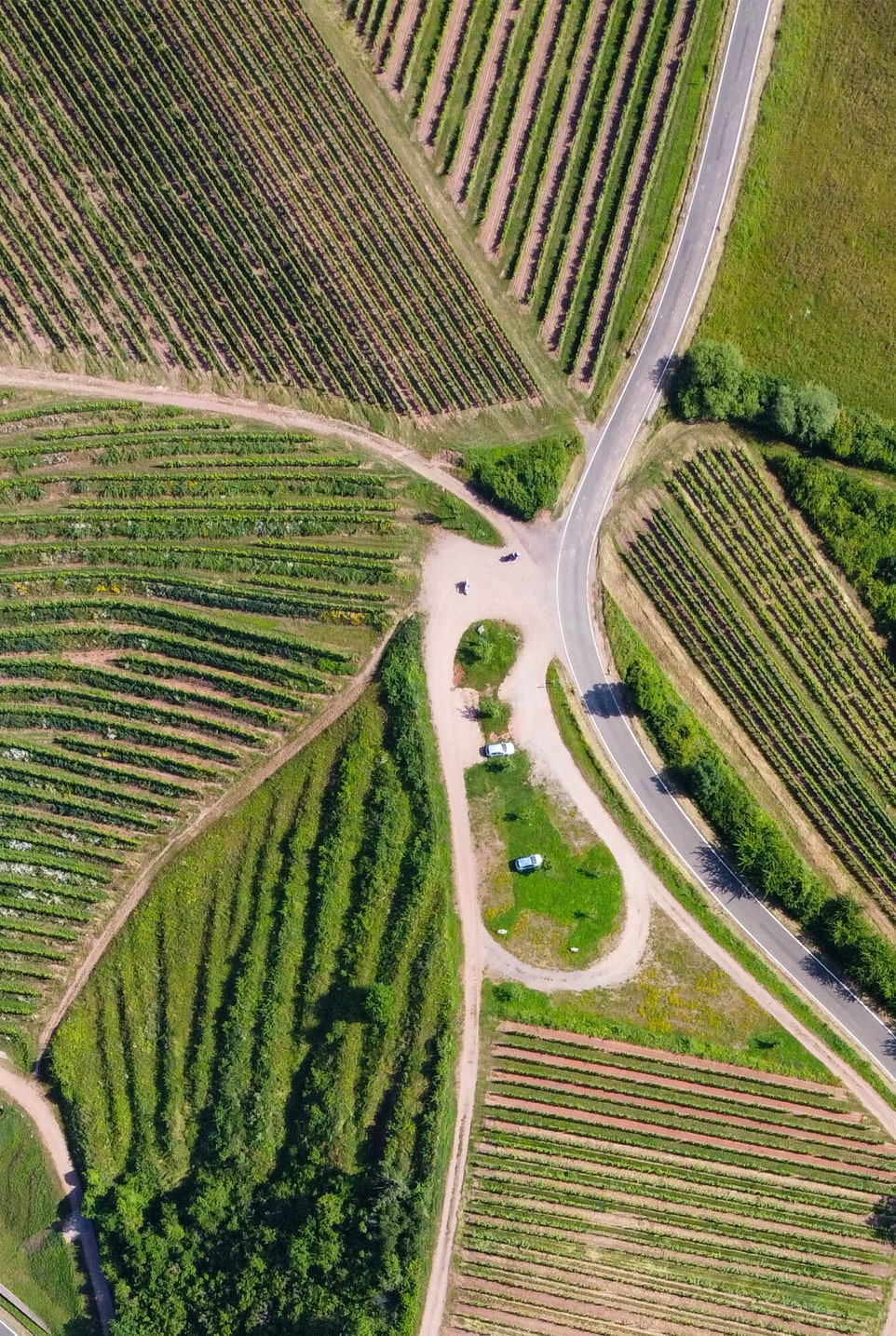
Farming with Precision Agriculture
Farmers use precision agriculture because they can reduce the amount of fertilizer applied to the field. It’s just one of many GIS applications in agriculture.
Because spraying is site-specific, it can save money on input costs. By attaching LiDAR to a tractor, they accurately measure biomass, heights, volumes.
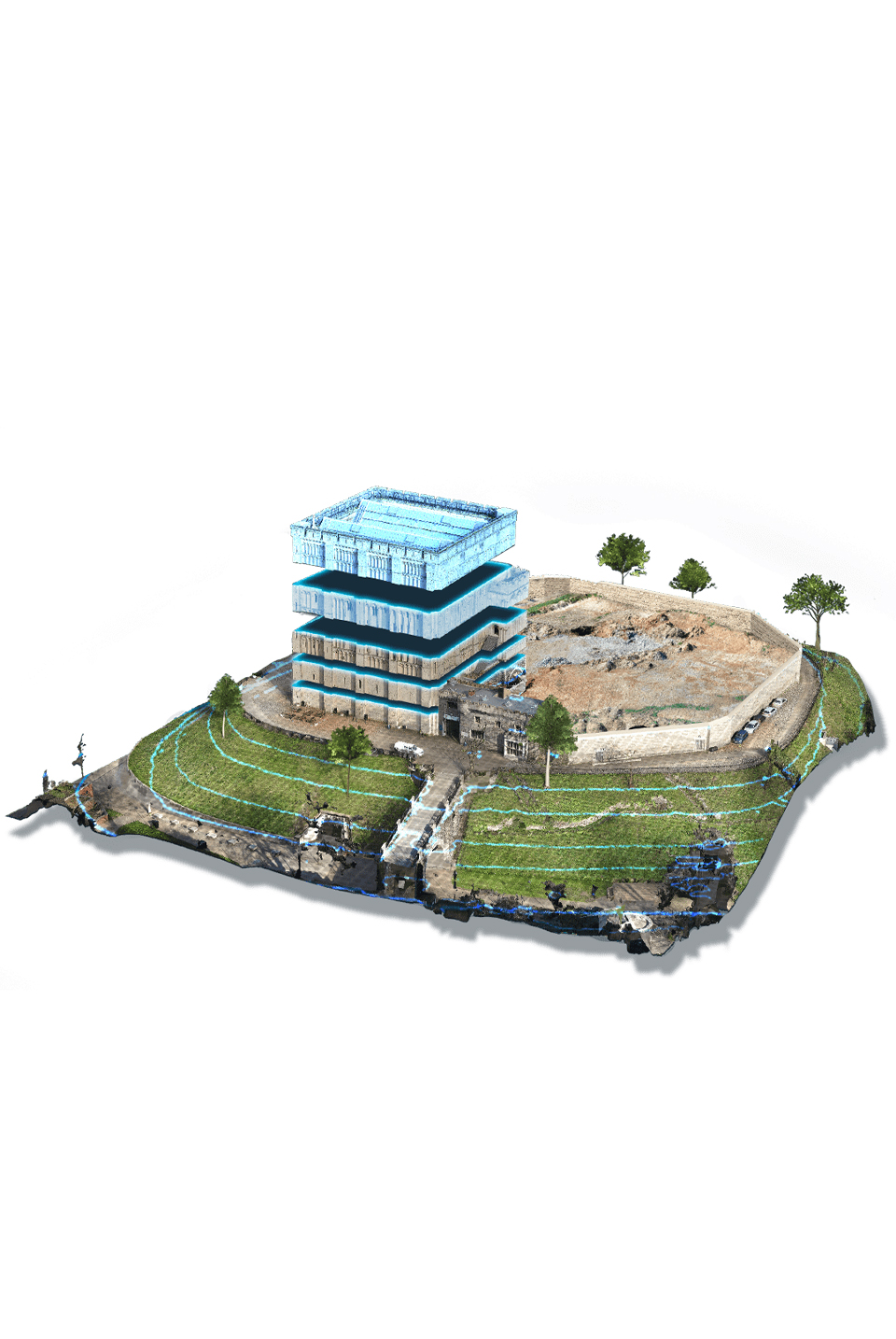
Mining
LiDAR is a method of measuring and examining the surface of an open pit mine or a pre-mining location using LiDAR sensors attached to drones. Lasers continually scan the surface, measuring the time it takes for the light to bounce off the earth and back to the sensor.
Combined with GPS information, this data is used to create a point cloud of elevation points across the area, which licensed professionals can then use to create accurate, high-resolution elevation models and 3D maps.